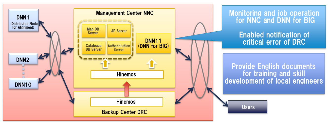
Hinemos has enabled the monitoring and job management of the system which are used for sharing spatial data between the National Mapping Agency of Indonesia and its 10 other ministries.
System Overview
This system is a network system for enhancing the administrative operation by sharing the spatial data between the government agencies of Indonesia. The spatial data is maintained for managing natural resources、social infrastructures、and regional development project of the Indonesian government agencies.
This system provides a National Spatial Data Infrastructure (NSDI) connecting all 11 ministries with National Mapping Agency of Indonesia in the center.